Where Is Masai Mara? Location, Map and Directions
If you look at Kenya like a rough triangle, Masai Mara sits wedged deep down in the bottom-left corner. Anyone planning an African safari asks the exact same starting question: where is masai mara, and how hard is it going to be to reach? The reserve lies in southwestern Kenya along the border of Tanzania, where it directly touches the northern edge of the Serengeti. It is not an isolated mountain retreat cut off from civilization, but it is far enough into the bush that reaching it requires either a bumpy overland haul or a quick hop in a small bush plane.
Geographically, the reserve belongs to Narok County. It covers roughly 1,510 square kilometers of open savanna, meandering rivers, and acacia scrubland. While people often call it a park, it is officially a national reserve managed by the local county government rather than the central Kenya Wildlife Service. Knowing where the land begins and ends matters quite a bit, mostly because your choice of entry gate determines whether your journey takes five hours or eight.
Book your masai mara safari tours experience:
Where is Masai Mara Located on the Map?
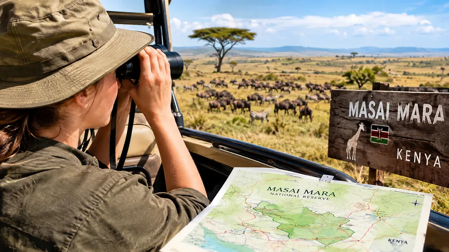
Looking at a Kenya masai mara map, the reserve occupies a specific pocket between the Great Rift Valley and Lake Victoria. The coordinates sit roughly at 1 degree 29 minutes South and 35 degrees 8 minutes East. To the west, the dramatic Siria Escarpment, also called the Oloololo Escarpment, rises like a massive wall above the Mara River, creating a natural border that marks the high western edge of the reserve.
South of the border line lies Tanzania. There is no physical fence between the two countries out in the bush. Animals drift back and forth between the Serengeti and the Mara completely unchecked, following green grass and seasonal rains. When travelers study where is masai mara in kenya, they often do not realize that the Masai Mara is actually the northernmost tip of the much larger Serengeti-Mara ecosystem. The Kenyan side makes up only about a tenth of that total area, but it holds a massive density of wildlife, especially when herds bottleneck near water sources.
Finding where is mara located relative to Kenya's natural landmarks is straightforward once you trace the Rift Valley. You leave Nairobi, climb up the shoulder of the eastern rift, drop down into the dry valley floor, and then angle southwest toward the Loita Plains. The reserve sits entirely within Narok County, roughly 110 kilometers south of Narok town itself. If you look at a maasai mara kenya map showing the whole region, you will see it ringed by community-owned wildlife conservancies that double the amount of protected land.
Many travelers also ask where is the masai mara in relation to the coast. Mombasa and Diani Beach sit hundreds of kilometers east across Kenya, roughly a 14-hour drive or an hour-and-a-half flight away. It is nowhere near the Indian Ocean, so combining bush and beach always requires routing back through Nairobi or catching one of the seasonal coastal bush flights.
Getting from Nairobi: Distance, Routes, and Travel Times
Most safari journeys begin in Nairobi, Kenya's capital city. The distance from nairobi masai mara runs anywhere between 225 kilometers and 280 kilometers, depending entirely on which gate you target. That might not sound like a huge distance on paper, but African road miles do not behave like highway miles back home.
The drive usually takes between five and six and a half hours. The first two-thirds of the trip follow paved roads, moving from Nairobi down the escarpment toward Mai Mahiu and on to Narok town. Narok is the last major supply hub on the route. Once you pass Narok and peel off toward the reserve gates, the tarmac eventually ends, turning into gravel, washboard dirt, and rocky tracks. If heavy rain hits, that final stretch can turn into thick, slick black cotton soil that tests even skilled four-wheel-drive safari drivers.
Scheduled flights bypass the bumps entirely. Most fly out of Wilson Airport (WIL) in Nairobi, a smaller airfield south of the city center that handles domestic and safari aviation. The flight takes around 45 to 60 minutes. Instead of one single central airport in the Mara, planes land on dirt bush strips scattered across the reserve and conservancies, dropping guests close to their specific camps.
| Route / Transport Type | Departure Point | Average Travel Time | Approximate Distance | Road or Track Condition |
|---|---|---|---|---|
| Road via Narok to Sekenani Gate | Nairobi City / NBO | 5.5 to 6 hours | 240 km | Paved highway to Narok; bumpy dirt after |
| Road via Narok to Musiara / Talek | Nairobi City / NBO | 6 to 7 hours | 260 km | Paved to Narok; rough dirt and gravel tracks |
| Scheduled Safari Flight | Wilson Airport (WIL) | 45 to 60 minutes | 225 km (air) | Compacted dirt or gravel bush airstrips |
| Overland from Lake Nakuru | Nakuru Town | 5 to 6 hours | 220 km | Paved highway heading south; unpaved past Mau Narok |
Pro tip: If you drive down the escarpment from Nairobi, stop at the Great Rift Valley viewpoint about 45 minutes out. The view across the floor is unreal, and it lets you stretch before the bone-shaking dirt section past Narok town kicks in.
Choosing between driving and flying comes down to budget and your tolerance for rough roads. Driving lets you watch rural Kenya unfold, from vegetable farms along the highway to Maasai herdsmen guiding cattle alongside the road. If you have limited vacation days, flying saves you two full travel days that you can spend out on game drives instead.
Gates and Entry Points Across the Reserve
Because the reserve covers a huge expanse of wilderness without internal fences, where is masai mara national reserve accessed depends on where you plan to sleep. Entering through the wrong gate can add three painful hours of driving through the park at 25 kilometers per hour just to reach your tent before dark.
The eastern side of the reserve handles the heaviest flow of road traffic arriving from Nairobi. The western and northern sections serve travelers visiting private conservancies or those driving in from Lake Victoria and western Kenya. Before setting your navigation, verify your camp's exact sector. If you are still sorting out where to stay, our guide to safari lodges and tented camps breaks down which properties sit inside the public reserve versus the quiet private concessions.
- Sekenani Gate: The main entry point in the east. It sits directly on the primary dirt road coming down from Narok town, surrounded by a small bustling trading center. Most road packages coming from Nairobi enter here.
- Talek Gate: Positioned in the central eastern edge along the Talek River. It offers direct access to the central plains, where wildlife density is exceptionally high during migration months.
- Oloololo Gate: Located in the northwest corner beneath the Siria Escarpment. This is the primary entry point for the Mara Triangle sector and camps located in the western reaches.
- Musiara Gate: Positioned in the north, convenient for visitors staying near the Musiara swamp or travelers arriving from the northern community conservancies.
- Ol Derokes Gate: A quieter entry post in the south-east corner, primarily serving private camps and community areas bordering the Loita Hills.
Note: Fuel stations do not exist inside the reserve itself. Top off your tank completely in Narok town, because running dry between Sekenani and Mara Serena will leave you stuck waiting on a friendly ranger patrol.
Entry fees are calculated per 12-hour or 24-hour cycle depending on county rules, and you must present payment confirmation electronically at these gates. Having cash ready to pay gate clerks rarely works anymore, as Narok County uses digital payment systems like eCitizen for visitor entry.
Book your masai mara safari tours experience:
Altitude, Landscape, and Climate across the Mara
A lot of travelers arrive completely unprepared for the weather because they do not realize the altitude masai mara sits at. This is not a low, sweltering coastal jungle. The reserve rests on an elevated plateau, with the masai mara altitude ranging from 1,500 meters (around 4,900 feet) above sea level in the river valleys up to 2,170 meters (over 7,100 feet) along the top of the Siria Escarpment.
Because of this high elevation, mornings are downright cold. When you roll out of bed for a 6:00 AM game drive, the air often hovers around 12 degrees Celsius (about 53 Fahrenheit). You will want a fleece, a windbreaker, and maybe even a warm beanie while the open safari vehicle cuts through the morning breeze. By midday, the equatorial sun climbs high, pushing temperatures up to a pleasant 26 or 28 degrees Celsius, before dropping sharply again after sunset.
The terrain is characterized by broad, sweeping grasslands broken by solitary desert date trees and thorny whistling thorn bushes. Two main rivers cut through this plateau: the Mara River and the Talek River. These waterways are the lifeblood of the ecosystem, holding water year-round even when the surrounding plains turn pale yellow in dry seasons. During July through October, the steep, muddy banks of the Mara River become the dramatic stage for the famous crossings during the Great Migration. If you want to see how these river crossings line up with the seasons, take a look at our Serengeti and Masai Mara migration guide.
Rainfall hits in two distinct cycles. The long rains fall across April and May, turning dry riverbeds into rushing brown currents and filling the black cotton soil with standing water. The short rains roll in during November and early December, usually arriving as quick afternoon thunderstorms that clear fast, leaving crisp air and vibrant green shoots across the savanna.
Understanding the Greater Mara Ecosystem
When someone mentions the masai mara game reserve location, they are often referring to the official public reserve. In reality, the physical wildlife haven extends far beyond those county boundaries. Surrounding the northern and eastern borders are more than a dozen community-owned wildlife conservancies, including Mara North, Olare Motorogi, Naboisho, and Olderkesi.
These conservancies were created through partnerships between private safari operators and local Maasai landowners. The Maasai families pool their private land plots, remove domestic cattle fences, and lease the land exclusively for eco-tourism and wildlife preservation. This setup has effectively doubled the protected habitat for elephants, big cats, and plains game. There are no physical barricades or fences separating the public reserve from these conservancies, so wildlife roams across the invisible lines freely.
Staying in a conservancy changes your geographical experience. While the national reserve allows high vehicle traffic and sticks strictly to designated dirt roads, conservancies enforce strict vehicle caps and permit controlled off-road driving and night safaris. If you are mapping out your trip, keep these practical navigation pointers in mind:
- Check your airstrip location: There are at least eight active bush strips, including Musiara, Keekorok, Ol Kiombo, Kichwa Tembo, and Ngerende. Ensure your bush flight books to the strip nearest your specific camp to avoid an unnecessary two-hour transfer across rough dirt tracks.
- Download offline maps: Cell phone coverage has improved dramatically across Narok County, but deep valleys and remote corners still suffer complete dead zones. Download regional maps to your phone before leaving Nairobi.
- Account for wildlife traffic: You cannot drive faster than 50 kilometers per hour inside the reserve, and real-world travel speeds often sit closer to 20 or 30 kilometers per hour due to potholes and animal sightings. A 30-kilometer drive between camps can easily take over an hour and a half.
- Watch river crossing points: The Mara and Talek rivers can only be crossed at specific bridges and stone fords. If a sudden thunderstorm raises the Talek River, your usual crossing point might become impassable, forcing a long detour around to the nearest bridge.
For independent travelers or self-drivers, knowing how to navigate these river crossings is critical. Getting stranded on the wrong side of the Talek River as dusk falls means an uncomfortable wait until the water recedes or a slow, stressful crawl in the dark toward a bridge miles away.
Frequently Asked Questions about where is masai mara
What country is Masai Mara in?
The Masai Mara is located in Kenya, in the southwestern region of the country within Narok County, directly along the border with Tanzania.
How far is Masai Mara from Nairobi?
It is roughly 225 to 280 kilometers southwest of Nairobi by road, which translates to a five to seven hour drive depending on which reserve gate you use, or a 45-minute scheduled flight from Wilson Airport.
Is Masai Mara the same as the Serengeti?
They are part of the exact same continuous ecosystem, but they are separate parks in different countries. Masai Mara is in Kenya, while the Serengeti is across the southern border in Tanzania.
Can you drive yourself to Masai Mara?
Yes, self-drive safaris are permitted, though you need a high-clearance four-wheel-drive vehicle, good mechanical knowledge, and offline GPS maps to navigate the rough unpaved roads and river crossings safely.
Quick Reference
- Country: Southwestern Kenya (Narok County)
- Coordinates: 1°29'S, 35°8'E
- Distance from Nairobi: ~240 km southwest
- Flight time from Wilson Airport: 45 to 60 minutes
- Average elevation: 1,500 to 2,170 meters
Book your masai mara safari tours experience:
The Bottom Line
Finding where is masai mara on a map is simple enough, but getting the logistics right on the ground makes all the difference between a seamless safari and a frustrating journey. Whether you choose to bump along the rural highways past Narok or skim over the Great Rift Valley in a light twin-engine plane, understanding the terrain, gate locations, and elevations will ensure you arrive ready for the open plains rather than exhausted by the transit. Pack a warm layer for those brisk morning game drives, double-check your camp's nearest entry gate, and prepare yourself for some of the finest wildlife viewing anywhere on the planet.
Read more about masai mara safari tours.